

Wildlife Conservation Initiative
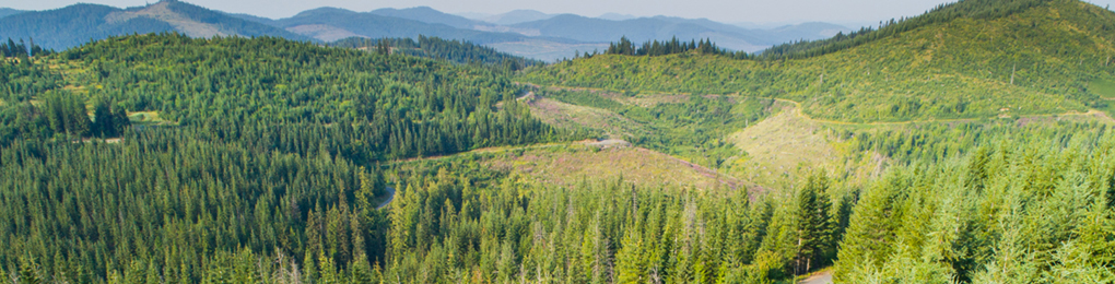
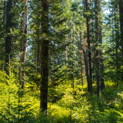
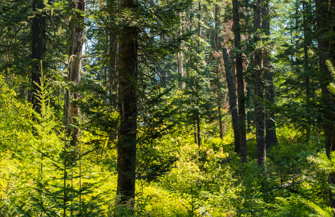
Working forests are critical to the effort to conserve biodiversity. PotlatchDeltic combines scientific data with our decades of experience sustainably managing forest lands to advocate for policies and regulations that recognize conservation values and reward landowners for the contributions that our managed forests provide.
The Wildlife Conservation Initiative (WCI) is a voluntary, collaborative partnership between the National Alliance of Forest Owners (NAFO), the U.S. Fish and Wildlife Service (USFWS), and the National Council for Air and Stream Improvement (NCASI) to create a trusted, durable relationship to implement science-based conservation for at-risk species. The underlying concept is recognition of the wildlife conservation benefits to at-risk species through active forest management in working forests, implementation of on-the-ground practices to conserve species, and use of third-party forest certification to provide assurances to the USFWS.
WCI began as specific, regional collaborations. PotlatchDeltic was a leader with other landowners of the WCI in Arkansas and the Lake States. We initiated the first meeting with the USFWS’s Arkansas Field Office to introduce the concept of third-party forest certification to the field office. In the Lake States, we led WCI efforts with the USFWS to design and expand the WCI partnership in the region. The initiative resulted in the USFWS recognizing the benefits of managed forest lands and best management practice (BMP) implementation in the USFWS’s Endangered Species Act (ESA) listing evaluations.
USFWS’s evaluations of aquatic species endemic to streams within the working forests of the southern United States have resulted in many determinations that the species were “not warranted” for listing under ESA. Where aquatic species have been listed based on non-forestry threats, the listing rules for these species have recognized forestry water quality BMPs as protective of the species. These are meaningful long-term results for landowners, and they serve as a testament to the conservation value of voluntary practices implemented on private working lands.
The key link with forestry is the recognition by the USFWS of the effectiveness of BMPs to protect water quality, and the understanding that BMP implementation is broad and consistent across all working forest lands. The breadth of implementation is a result of landowners certifying their lands and companies that buy wood fiber adopting the Sustainable Forestry Initiative® (SFI) certified fiber sourcing standard, which requires that all wood delivered/purchased is harvested consistently with applicable forestry BMPs.
The WCI has strengthened and expanded since it was initiated in 2016 and now has cooperative landowner-USFWS projects in all the primary timber growing regions. The projects include species surveys, habitat research projects, and dialogue on how to simplify and reduce the administrative and regulatory burden of expanding conservation of listed species on private lands.
In 2023, NAFO, USFWS, and NCASI signed a Memorandum of Understanding (MOU) formalizing the WCI as a collaborative conservation partnership focused on proactive and voluntary conservation. The MOU promotes cooperation and collaboration and creates consistency as a USFWS agency-wide initiative. Under the MOU, PotlatchDeltic, other NAFO members, and USFWS are developing conservation agreements to provide for research and species monitoring to increase the understanding of the conservation value of active forest management on listed or rare bat species. The agreements will facilitate access to private forests for public and private research, provide the USFWS with new data, and will provide a net conservation benefit to listed and at-risk bats.
Identifying Special Sites
Sustainable forestry requires a thoughtful balance between responsible resource management and the protection of ecologically, culturally, and historically significant sites. At PotlatchDeltic, foresters combine technology with hands-on expertise to identify and preserve these special places, so that forests remain productive while safeguarding their conservation value.
Some areas within working forests hold unique ecological or cultural importance. These sites may include rare ecosystems, critical wildlife habitats, historic landmarks, and indigenous cultural sites. PotlatchDeltic follows rigorous standards, as required by the Forest Stewardship Council® (FSC®) and Sustainable Forestry Initiative® (SFI®) standards. Identifying and protecting these places requires more than just policy - it takes careful planning, innovative technology, and deep local knowledge.
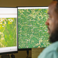
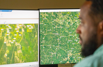
Before any operational activities begin, foresters follow a robust standard operating procedure, which includes using Geographic Information Systems (GIS) to analyze spatial data, overlay habitat and environmental restrictions, and pinpoint areas that require special care. By identifying these areas early, foresters can make informed decisions that balance conservation with responsible land use.
Technology has significantly improved the ability to detect and protect special sites. For example, drone technology has helped foresters locate sensitive wildlife habitats, such as gopher tortoise burrows, that might otherwise go unnoticed. However, technology alone isn’t enough. Engaging with local stakeholders, including indigenous groups and historical societies, adds a crucial layer of insight. These collaborations help verify a site’s cultural and environmental significance.
Once identified, these special sites can become an integral part of PotlatchDeltic’s conservation strategy. Protections are embedded into the company’s GIS database, so that conservation measures can be considered in connection with timber harvesting, road placement, and land-use planning. Foresters carefully tailor conservation efforts to each site’s unique needs. In areas with endangered species, buffer zones are established, and harvest schedules may be adjusted to minimize disturbance. For newly discovered nesting sites, forestry operations may be postponed until the nesting season concludes, so that wildlife populations can remain undisturbed. In riparian zones, best management practices focus on protecting water quality and maintaining habitat conditions for aquatic species.
Training plays a vital role in maintaining these protections. Foresters and contractors are equipped with knowledge and tools that enable them to recognize special places in the course of their field work. Structured environmental management systems bring conservation priorities to the forefront, with automated planning tools that flag restrictions tied to sensitive areas. Annual inspections and compliance monitoring on larger, unique aeras further reinforce these safeguards, so that special places can continue to provide ecological and cultural value over time.
The importance of safeguarding special places has never been greater. By integrating technology, stakeholder engagement, and best management practices, the company takes steps to safeguard critical habitats, historic sites, and high conservation value areas while maintaining a sustainable supply of timber. PotlatchDeltic’s approach demonstrates that sustainable forestry and conservation can coexist.
Conserving Rare Species in Arkansas
How does PotlatchDeltic conserve biodiversity across a land base that ranges from mountains to forests with dense, thorny vines and brambles? We do our homework! We work with partners, apply advanced mapping tools, conduct training, and make field inspections to locate and conserve rare species.
In our Ola, Arkansas timberlands, we conserve rare species in the Ouachita and Boston Mountain ranges through our management initiatives. We have a long history of partnering with the Arkansas Natural Heritage Commission (ANHC) to acquire location data on rare species occurrences. After we receive the location data, we investigate the life history of the species that overlap our lands so that we can determine the measures we need to integrate into our forest management plans to promote the conservation of the species. We then place map-based notifications within our Land Resource Manager system to alert foresters to the locations where the species occur and the requirements for species conservation.
In the northeastern part of our Ola district, several rare aquatic species occupy the stream reaches that run through our working lands. The rabbitsfoot and speckled pocketbook mussels and yellowcheek darter (all federally protected species) are found in Archey Creek, Beech Fork, and the Middle Fork of the Little Red River. These are small to medium rivers with moderate to swift currents, and smaller stream tributaries that have gravel or cobble bottoms and sand bars with riffles and intermittent pools. The populations of these species have declined in many portions of their range but still occupy these streams and rivers because of the water quality coming from their mostly forested watersheds.
When our foresters plan and implement harvests, they work to eliminate as many stream crossings as possible. When a stream must be crossed, they design, build, and maintain crossings to minimize sedimentation and not impede stream flow. The U.S. Fish and Wildlife Service has maintained that these considerations and the implementation of Arkansas’ water quality best management practices for forestry protect these species. Move 50 miles west within our Ola district to Dry Fork Creek and you will find our conservation efforts for a federally endangered plant called harperella. Harperella is a perennial herb and a member of the carrot family that smells a little like dill. It is also known as Bishop’s weed. The ANHC periodically surveys the site and provides information we use in our mapping system. Our foresters use the map data to incorporate measures into prescriptions to conserve the population, such as applying herbicide in a way that doesn’t contact the plant. The reason harperella occupies this site is likely the result of the conditions that gave Dry Creek its name. The creek experiences natural short-duration spring floods and when they subside, harperella seeds germinate and complete their life cycle with their root systems in puddled areas or saturated soils that are left behind.
Our foresters also protect glades, which simply means “open space in forest.” The glades are found in the rougher, northern portions of the Ola district located in the Boston Mountains and are openings occurring within our timberlands, on rocky outcrops on south and west facing slopes. The combination of shallow soil and direction of slope produces a hot, dry environment with thin, rocky soil which will not support the rapid growth of trees. The glades are surrounded by productive forests and, when we harvest adjacent to the glades by thinning or clearcutting, we expand the open habitat and amount of herbaceous vegetation. This benefits species such as the collared lizard, Bachman’s sparrow, bluewinged warbler, eastern towhee, hooded warbler, red-headed woodpecker and the prairie warbler. These are all species that have been identified in the Arkansas State Wildlife Action Plan as being of greatest conservation need. The thin soils on the glades are a harsh natural environment for plants and only those that are uniquely adapted to the conditions are found such as birdsfoot violet, Indian paintbrush, Missouri evening primrose, lanceleaf tickseed, purple blazing star and pale purple coneflower. The plains scorpion and tarantula spider may also be found in the warm, dry conditions of the glades.
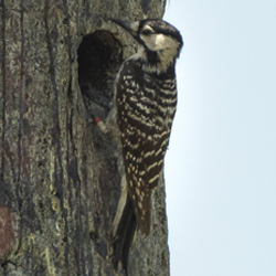
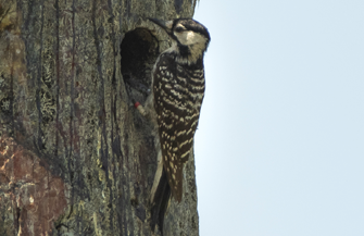
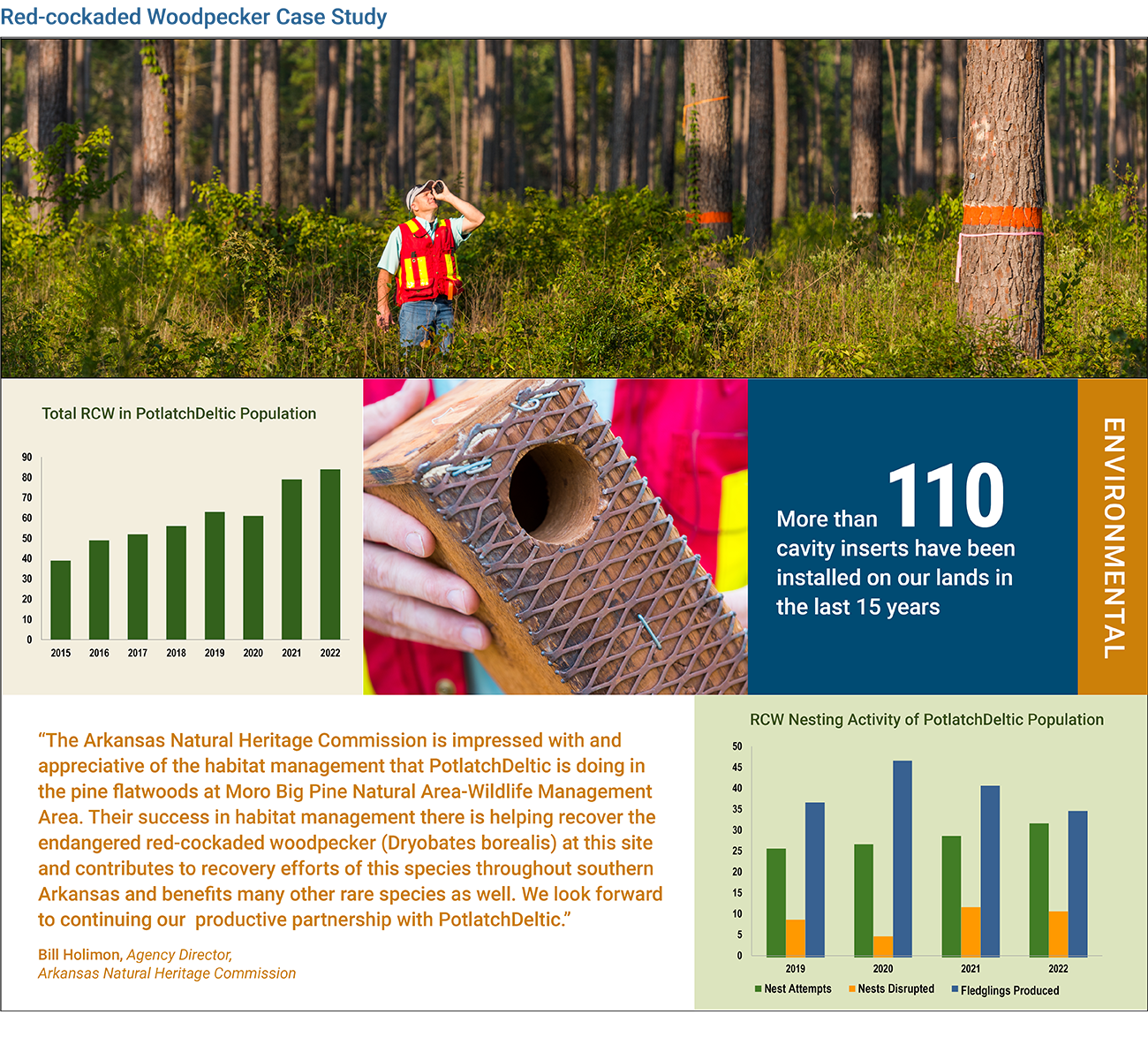
Moro Big Pine: Red-Cockaded Woodpecker
PotlatchDeltic occasionally enters into formal agreements with nonprofit and governmental agencies that limit timber harvesting or development on our forestland. We offer such easements to support the recovery of a threatened or endangered species, or to preserve places and landscapes that have exceptional natural, social, or cultural value. We are especially proud of the conservation easement that we use as part of the habitat conservation plan for the endangered red-cockaded woodpecker (RCW) in Arkansas.
The RCW was listed as an endangered species in 1970. Its numbers had dropped to an estimated 15,000 from an original population of 1.5 million but has since shown recovery. It is a habitat specialist occupying fire-maintained open pine woodlands and savanna and is the only woodpecker in North America to excavate cavities in living pine trees, which they utilize for roosting and nesting. They practice cooperative breeding, a social system in which some mature adults forgo reproduction and instead assist in raising the offspring of others. These characteristics contribute to the importance of available cavity trees and prescribed fire to provide habitat for breeding groups and maintain healthy populations.
In 1995, we entered a historic partnership with the U.S. Fish and Wildlife Service to create a habitat conservation plan, or HCP, for the RCW, providing a variety of strategies for encouraging the bird’s recovery. More recently, we rewrote the HCP and embedded it in a 15,961-acre conservation easement in prime RCW habitat. This easement was originally acquired by The Nature Conservancy and is now held by the State of Arkansas. It is known as the Moro Big Pine Wildlife Management Area and the working forest conservation easement, sets these lands apart in perpetuity.
Biologists from Wire Grass Ecological Associates monitor the red-cockaded woodpecker population on our lands, conducting an annual survey and banding all nestlings. Our researchers also regularly use “video peepers” to investigate the tree cavities where the RCW nests.
The 2018 merger with Deltic Timber Corporation brought a small number of RCWs scattered in non-viable demographic settings, and we translocated them to Moro Big Pine. Following the merger, we visited all sites with recorded observations of RCWs to determine if they were active, the number of RCW present, and their proximity to other RCWs. We also surveyed areas with potential for RCW cavity trees to determine if there were previously unknown locations with RCW. Our assessment revealed seven sites with RCWs present or with signs of RCW use within the last few years and that they were all demographically isolated, meaning that there were no other RCWs close enough to their nesting locations to fill breeding vacancies created by the loss of a mate or to allow offspring to find other RCWs and become breeders.
We then initiated permit applications with the U.S. Fish and Wildlife Service to allow translocation of the isolated RCWs to our Moro Big Pine Wildlife Management Area in southcentral Arkansas. With permits secured, the fieldwork of capturing and translocating RCWs was initiated in early April of 2020. Capturing RCWs is conducted using well-developed protocols to ensure successful relocation and requires many hours of early morning and evening observations of cavities to determine roost locations. Nets with long poles that allow for capture of RCW from their roost cavities located 30-70 feet above the ground. All the RCWs on the new lands - a total of six, consisting of two pairs and two singles from four different sites - were translocated. The RCWs were moved to high-quality habitat on Moro Big Pine, which increased the population size and viability there, where cavity trees are readily available and fire is used to maintain open pine, high-quality habitat.
Twenty years of habitat management and translocation of RCWs to improve population viability has resulted in the population on Moro Big Pine growing from 24 adult birds with 9 potential breeding groups to the 2023 population of 87 adults with 30 potential breeding groups. The population also includes an additional single bird group that undoubtedly aspires to become a potential breeding group. The RCW population on Moro Big Pine is now large enough that we are working in partnership with the Arkansas Natural Heritage Commission to translocate sub-adults from Moro to other small RCW populations in Arkansas to increase their genetic diversity.
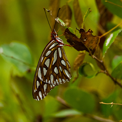

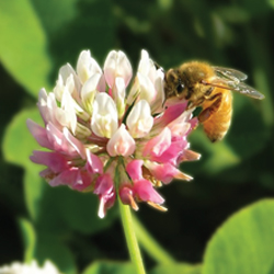
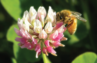
The Importance of Pollinators
On a warm spring morning, a native bumblebee hovers over a recently harvested section of a PotlatchDeltic forest, collecting pollen before darting towards a stand of young pine trees. This seemingly small act is part of a much larger story, one where sustainable forestry and pollinator conservation go hand in hand.
Pollinators, such as bees, butterflies, and moths, are essential to the health of forest ecosystems, playing a vital role in the reproduction of many tree species and understory plants. These plants serve as food sources for wildlife species like deer, turkeys, and songbirds, underscoring the role of pollinators in the broader food web.
The interdependence between forests and pollinators extends to agriculture. Proximity to forested areas has been shown to enhance pollination services for nearby crops. For example, plantations of apples, almonds, or coffee can increase their yield by up to 20% with the help of native pollinators from nearby forests or grasslands.
At PotlatchDeltic, sustainability isn’t just about timber production, it’s includes maintaining ecosystems where pollinators can thrive. Forests provide critical habitats for diverse pollinator species, offering sites for reproduction and foraging resources that are often scarce in other areas.
One of the most valuable habitats for pollinators arises naturally in working forests: early successional habitat. After timber is harvested, sunlight is allowed to reach the ground, promoting the growth of diverse flowering plants, grasses, and shrubs that provide essential nectar and pollen resources.
At PotlatchDeltic, we harvest approximately 3% of our timberland each year. This creates a regular supply of timberland with the conditions needed for an early successional habitat, creating opportunities for newly available pollinator foraging grounds to develop. As a result, butterflies, native bees, and other pollinator species benefit from an ongoing cycle of habitat availability, a prime example of how working forests can actively contribute to biodiversity.
PotlatchDeltic has long implemented science-based forestry practices to maintain diverse, thriving habitats for pollinators and other wildlife. These include:
- Strategic harvest scheduling: Maintaining a steady supply of early successional habitats across the landscape.
- Green-up and adjacency planning: Creating a mosaic of different habitat stages.
- Forest edge retention and daylighting roads: Allowing sunlight to reach the forest floor, encouraging the growth of pollinator-friendly plant species.
These management practices are designed to ensure that working forests remain productive, while also serving as havens for biodiversity.
To deepen its commitment to pollinator conservation, PotlatchDeltic works with the Wildlife Conservation Initiative (WCI), supporting essential research on pollinator health. As some pollinator populations continue to decline, understanding species diversity, habitat use, and population trends has become more important than ever. Through WCI’s research projects, scientists are gathering data that will provide critical information to implement science-based conservation for at-risk species.
PotlatchDeltic’s sustainable forestry management practices help ensure that its working forests remain productive, resilient, and rich in biodiversity for generations to come.
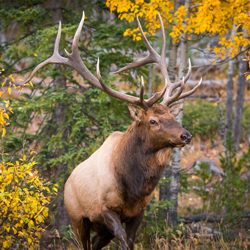
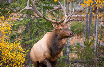
Elk / Ungulates in Northern Idaho
In Northern Idaho, elk, deer, and moose are vitally important to rural communities’ culture, traditions and economy and serve societal needs such as game animals or subsistence foods. These large ungulates can also affect native vegetation and agricultural crops because of their large body size, diet choices, and widespread distributions. PotlatchDeltic recognizes the importance of these species and maintaining healthy herds in balance with native vegetation. As a result, we have made substantial commitments to research, conservation and public recreation through partnerships with the Idaho Department of Fish and Game (IDFG) and others.
Studies led by IDFG in collaboration with PotlatchDeltic and others have focused on investigating the Rocky Mountain elk (Cervus elaphus canadensis) on company timberlands and adjacent public ownership. Studies have examined population levels, nutrition and reproductive levels and their relationship to land management.
The Clearwater Basin Collaborative, a citizen partnership with federal, state, and private collaborators that began in 2013 and continues today, is another research collaborative in which PotlatchDeltic has partnered. The purpose is to understand animal fitness, nutritional status, and habitat use across the Clearwater Basin, and synthesize this knowledge for landscape restoration of early seral habitats to benefit elk and other wildlife.
Access to lands and the ability to capture, mark, and monitor animals is a key underpinning of the ungulate research. PotlatchDeltic has developed several Memorandums of Understanding with IDFG to make lands available for capture and to facilitate the state-led research and monitoring. The long partnership on research has included IDFG deploying remote cameras to estimate elk and wolf abundance, collaring elk and moose by aerial netting and darting, and land-based deer trapping followed by tagging or collaring and radio telemetry tracking. These studies allowed researchers to determine abundance, survival rates, habitat use, and cause-specific mortality of these animals to better inform their species management.
We provide public access across our Idaho timberlands and entered into a lease agreement with IDFG to provide public access to 567,000 acres for hunting, fishing, hiking, wildlife viewing and recreational travel on open full-sized roads.
Elk hunting is a primary public use of PotlatchDeltic's Idaho timberlands. The combination of public access and working forests that provide a sustained supply of early successional habitat intermixed with escape cover found in mid-aged stands has resulted in high quality elk habitat and prime hunting territory for sportsmen.
The Idaho Game Management Units (GMUs) with the highest sustained elk harvest and highest levels of recreational use include those with PotlatchDeltic lands. Game Management Unit 6 (St. Joe) and 10A (Dworshak), which contains the largest amount of our company ownership, are consistently ranked in the top 3 elk harvest GMUs in the state.1
- Harvest and Hunter days from the Idaho Department of Fish & Game (IDF&G) website.
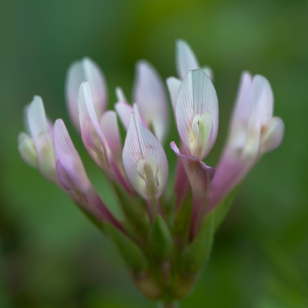
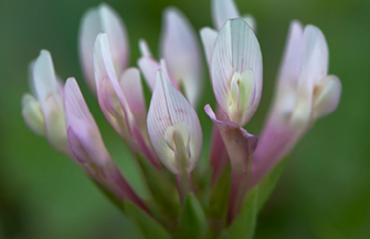
Fringed Campion
In Talbot County, GA a special site has been designated covering 99 acres to ensure the protection of the endangered Fringed Campion. The Fringed Campion is a low-growing, perennial herb that forms colonies by runners or stolons that creep along the ground. The species produces large, bright pink flowers with fringed margins that bloom in the spring. The showy flowers produce nectar utilized by beetles, moths, and butterflies. It is found in only a small number of counties in Georgia and northern Florida. The species is globally imperiled and is federally listed as Endangered.
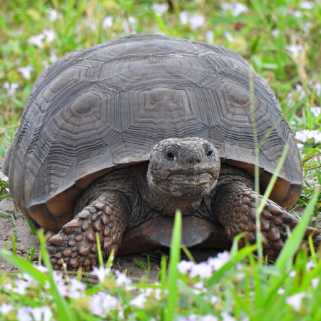
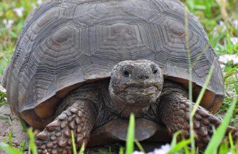
Gopher Tortoise
Native in the southeastern U.S., the Gopher Tortoise is a keystone species because it digs burrows that provide shelter for at least 360 other animal species. PotlatchDeltic gives special attention to Gopher Tortoises and protecting their habitat. Our foresters do so by tracking locations of known burrows and avoiding mechanical site preparation or harvests near them. In addition, we regularly plant with wider spacing between rows, which promotes growth of plants the tortoise uses for forage. Tortoises often place their burrows in gaps in the tree canopy created by thinning.
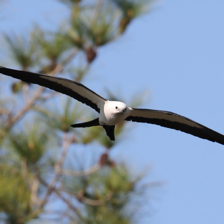
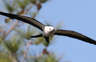
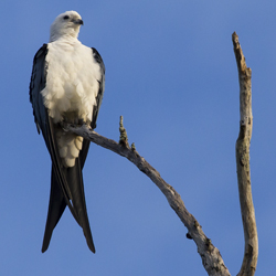
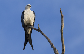
Swallow-Tailed Kite
Listed as “endangered” by South Carolina, and as “rare” by Georgia, the Swallow-tailed Kite and its nesting area is a priority for protection by our foresters. We have a proactive plan in place that ensures protection of the majestic Swallow-tailed Kites that nest in our timberlands. This plan includes monitoring nesting, tracking nest locations, and protecting trees with active or inactive nests, minimizing heavy machinery activity within a half-mile of known nest sites during the nesting season, and avoiding harvesting clumps of dominant, tall trees within Streamside Management Zones (SMZs), which are common nesting areas.
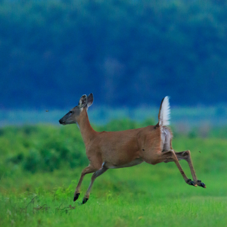
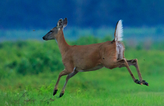
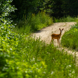
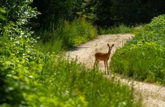
Chronic Wasting Disease
Chronic Wasting Disease (CWD) is a highly contagious fatal disease that affects deer and related species such as elk and moose. No cases of CWD infecting humans are known. The neurological illness typically causes infected animals to exhibit a shaggy coat, weight loss, and a wider wobbly stance. The disease was first detected in Colorado in 1967 but has since spread to 35 states and five Canadian provinces.
CWD is caused by a prion, or misfolded protein and can spread through contact between animals, with the saliva, blood, or waste of an infected animal, and with contaminated soil or plants. No treatments or vaccines are currently available, and no methods exist that can remove CWD from the landscape. The expansion of CWD negatively impacts environmental, economic, and cultural values.
PotlatchDeltic coordinated with peers to lead a coalition of private landowners to develop non-regulatory, voluntary guidelines for CWD Best Management Practices to manage and mitigate the negative impacts of CWD and to educate recreational users. The guidelines include measures surrounding: 1) the prevention of CWD introduction and establishment, 2) surveillance of CWD, 3) the management of CWD, and 4) additional support activities.
CWD Best Management Practices targeting prevention include discouraging human-assisted movement of live deer and related animals onto a landowner’s property and unnatural concentrations of the animals through practices like baiting or feeding. In addition, landowners agreed to support or advocate state or provincial efforts restricting the movement of high-risk carcass parts.
Surveillance measures include promoting educational materials for recreational users, encouraging recreational user participation in state agency organized CWD sampling efforts and proactively reporting any suspect animals, supporting research that will improve CWD testing or management, and working with state agencies as they implement their CWD response plans.
The practices recognize that in order to manage the prevalence of CWD, landowners will need to continue communications and education of recreational users. Additional support can be provided through working with state agencies and by supporting research.
Through partnering with other landowners and state agencies, we strive to slow or halt the progression of this disease. Our efforts also reflect how we respond to new challenges or risks and work collaboratively with others towards protecting our forests and all that is within them.